
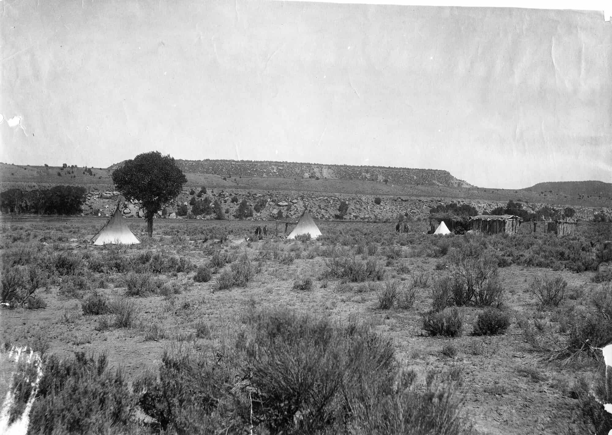
 Ute Camp, Rio Grande County. Photo credit: Denver Public Library Special Collections.
Every house listing in Colorado comes with square footage, school-district ratings, and maybe a view. Rarely does it mention the land’s deeper history. Yet the terrain beneath our yards, the ridge lines behind our homes, and the plains beyond our fences have been shaped for centuries by Indigenous nations who called them home long before property maps appeared.
The First Stewards - Indigenous Colorado Nations
Long before deeds and fences, the Ute people moved through what’s now the central and western parts of the state, following seasons and elevation. The plains to the east were home to the Arapaho and Cheyenne, who lived from what the land provided and treated its boundaries as fluid, not fixed.
The Apache and Shoshone traveled through, too, their routes cutting across the mountains and into the high plains. What we now call “territories” were, to them, networks of relationship… places defined by movement, not ownership.
Today, the Southern Ute and Ute Mountain Ute remain in Colorado. The reservations today are the remaining sovereign homelands of those nations, though starkly reduced from their historic range.
The Ute Tribes
Start almost anywhere on the map and you’ll find the Ute. The state’s name itself comes from them, though that origin has mostly been reduced to branding — ski runs, high schools, and the license plates that blur past on I-70. The Ute people lived throughout the Rockies long before Europeans set foot in the region, moving seasonally between the high country and the valleys. Their three bands (Mouache, Capote, and Weeminuche) once ranged across nearly all of western and southern Colorado.
Today, the Southern Ute Indian Tribe and the Ute Mountain Ute Tribe maintain reservations in the southwest corner of the state. The Northern Ute, now in Utah, were pushed west during the 19th century. If you’ve ever driven through Durango or Cortez, or stopped for gas near Ignacio, you’ve passed through what remains of their homeland — a landscape that still carries their language in its contours.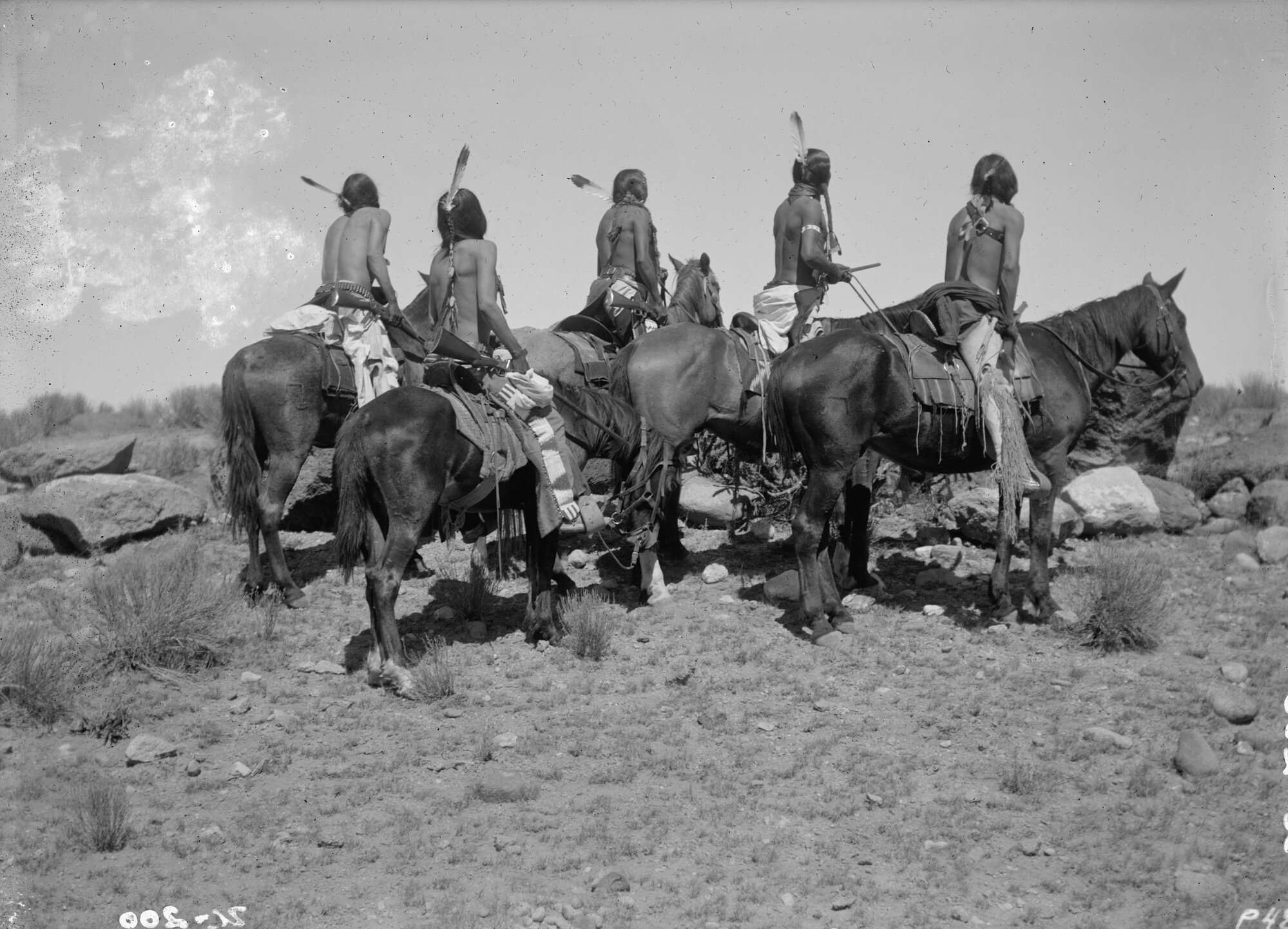 Ute War Party. Photo credit: Denver Public Library Special Collections.
The Arapaho and Cheyenne People
East of the mountains, the story changes shape. The rolling plains that now hold Denver, Aurora, and Colorado Springs were home to the Arapaho and Cheyenne, whose self-names are Hinono’eino and Tsétsêhéstâhese. Their homes followed the rhythm of the buffalo herds, tracing the South Platte and Arkansas Rivers long before either had names. The two nations formed alliances for trade, protection, and ceremony. Today, the Northern Arapaho live in Wyoming, and the Cheyenne and Arapaho Tribes are based in Oklahoma — a geography redrawn by force, not choice.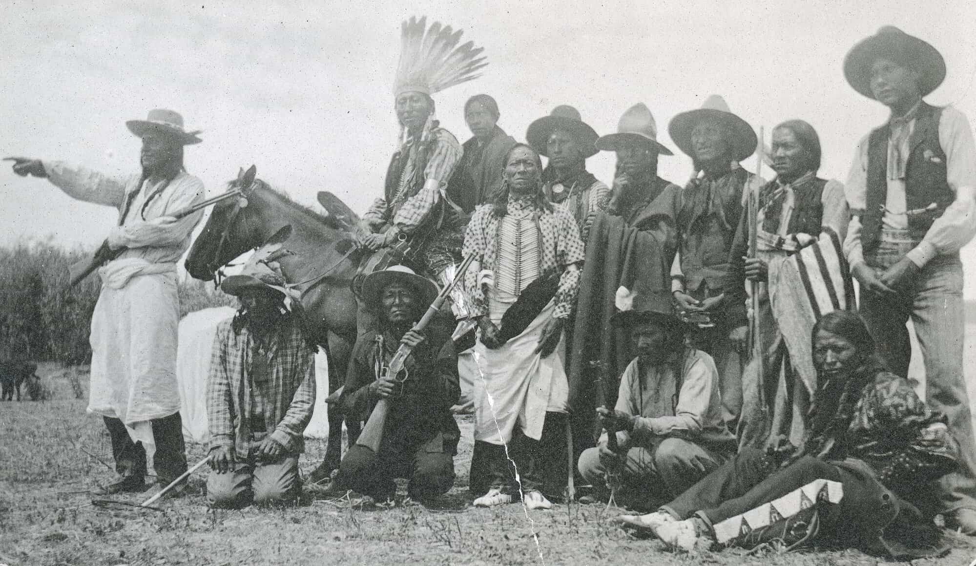 Cheyenne posing outdoors. Photo credit: Denver Public Library Special Collections.
The Apache and Comanche Nations
Move further south and you find the Apache (the Ndé), whose homes stretched from New Mexico up into southeastern Colorado. The Comanche, skilled horsemen and traders, extended their reach here too, dominating the southern plains through the 1700s and early 1800s. To the northwest, the Shoshone and Eastern Shoshone lived and hunted across the sage valleys near today’s Routt and Moffat counties, their territories brushing the edges of what’s now Wyoming and Utah. Comanche Woman. Photo credit: Denver Public Library Special Collections.
The Shoshone’s Homelands
Northwestern Colorado once bordered the Shoshone and Eastern Shoshone homelands. They traded and sometimes fought with neighboring tribes across what’s now Wyoming, Utah, and Idaho. Their reach extended into the high basins and sage valleys that modern Coloradans drive through on their way to Steamboat or Dinosaur National Monument Shoshone near tepees. Photo credit: Denver Public Library Special Collections.
Invisible Treaties and Gold-Driven Greed
The modern idea of land ownership doesn’t translate to Indigenous worldviews. For most nations here, the land was not something to possess but to live with. Territory meant relationship… with water, soil, game, and neighboring peoples.
The 1851 Treaty of Fort Laramie recognized huge swaths of land in eastern Colorado as Cheyenne and Arapaho territory. Less than fifteen years later, after gold was discovered near Denver, settlers flooded the region. The treaty boundaries vanished from practical use. In 1864, the Sand Creek Massacre (carried out by Colorado volunteer soldiers) left more than 200 Cheyenne and Arapaho people dead. Many survivors fled the state permanently.
It’s one of those historical facts that doesn’t appear on real estate brochures, though the massacre site sits less than 180 miles from the capital.
None of this changes the homes we live in now. It doesn’t alter appraisals or mortgage rates. But it complicates the idea of place. Colorado’s neighborhoods didn’t appear from nowhere; they rose on the layered ground of migration, conflict, and survival. The soil beneath your lawn likely once hosted tipi rings, trading paths, or hunting routes. The trail systems we brag about — those long, switchbacking lines into alpine meadows — often trace Indigenous routes that predate modern hiking culture by centuries. A Handshake with Cheyenne. Photo credit: Denver Public Library Special Collections.
The Coloradan Irony
There’s an irony in how Coloradans talk about “connection to the land.” We garden, hike, ski, and camp as a form of communion. We romanticize open space. Yet we rarely name the peoples who understood and cared for this land first… and still do. That understanding doesn’t require shame, but it does ask for awareness.
Several organizations make that easier. Native Land Information System, an Indigenous-run nonprofit, has an interactive map where you can search your address and learn whose territory you occupy. In Denver, the Four Winds American Indian Council and the Denver Indian Center maintain cultural programs and community resources that connect residents — Native and non-Native alike — to the region’s Indigenous heritage. The Southern Ute Cultural Center and Museum in Ignacio offers a view into the continuity of Ute history in a state that often speaks about Native people in the past tense.
You don’t have to rewrite your deed or rename your street. But you can connect with an organization, visit a museum, and understand the history. You can know the names that came before: Mouache, Capote, Weeminuche, Hinono’eino, Tsétsêhéstâhese, Ndé.

Laurel Cisneros


Socials